

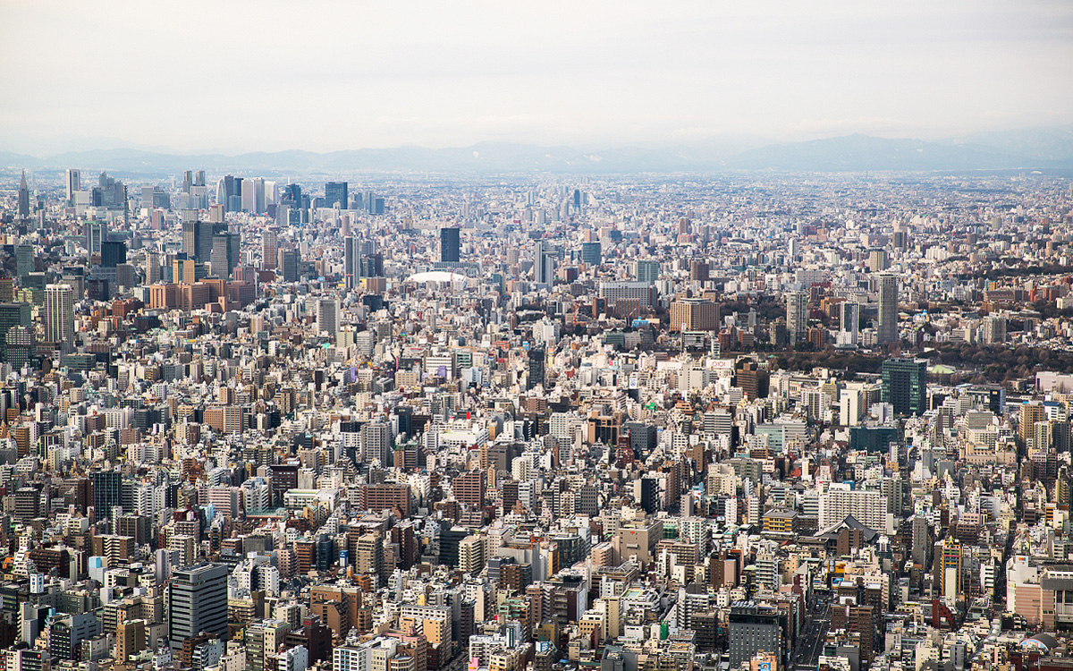
For the first time in human history, more people live in cities than anywhere else.
That shift happened in 2007. Quietly, without announcement, the urban population of Earth crossed 50%. And it has not stopped growing since.
Cities are where most human life now unfolds, where most economic activity happens, where most political decisions are made, where most cultural production occurs, and where most environmental pressure is concentrated. Understanding urban environments is not just a geography topic. It is an attempt to understand the world as it actually is, and as it is rapidly becoming.
Urbanization is the process by which an increasing proportion of a population comes to live in urban areas. It is driven by two interconnected forces: rural-urban migration (people moving from the countryside to the city) and natural population increase (birth rates exceeding death rates within cities themselves).
Urbanization is not a new phenomenon; cities have existed for thousands of years. But the scale and speed of contemporary urbanization are historically unprecedented. In 1800, only about 3% of the world's population lived in cities. Today, that figure exceeds 57%, and by 2050, it is projected to reach 68%.
The geography of urbanization has shifted dramatically. In the 19th and early 20th centuries, the fastest urbanization occurred in Europe and North America, driven by industrialization. Today, the fastest urbanization is happening in sub-Saharan Africa and South Asia, where cities are growing by millions of people each year, often faster than governments can provide housing, infrastructure, or services.
Migration to cities is driven by a combination of forces that push people away from rural areas and pull them toward urban ones.
Defining and measuring urban areas is more complex than it first appears. Different countries use different definitions; some define urban areas by population size, others by population density, others by economic function. This makes international comparison difficult.
Key terms used in Geography include:
Geographers have developed models to explain how cities are organized internally, how different land uses (residential, commercial, industrial, recreational) are distributed across urban space.
Ernest Burgess proposed that cities grow outward from a central point in concentric rings. At the center is the Central Business District (CBD), surrounded by a zone of transition (older industrial and mixed-use areas), then successive rings of working-class housing, middle-class housing, and commuter suburbs at the outer edge. This model was based on Chicago in the early 20th century.
Homer Hoyt proposed that cities develop in sectors rather than rings, radiating outward along transport routes from the CBD. High-income residential areas develop along attractive corridors (near parks, away from industry), while industry follows transport lines such as railways and rivers. This model better accounts for the influence of transport on urban structure.
This model proposed that cities do not grow from a single center but develop around multiple nuclei — different activity centers that attract specific land uses. An airport generates hotels and cargo facilities around it. A university generates student housing and coffee shops. This model better reflects the complexity of modern cities.
Limitations of Models — All urban models are simplifications. Real cities are shaped by historical development, topography, political decisions, cultural preferences, and economic forces that no single model can fully capture. They are most useful as frameworks for thinking about urban structure, not as precise descriptions of reality.
The experience of urbanization differs significantly between high-income countries (HICs) and low-income countries (LICs).
In high-income countries, urbanization largely occurred during industrialization in the 18th and 19th centuries. Most HICs are now highly urbanized, with over 80% of the population in the UK, USA, and Australia living in urban areas. The current trend in many HICs is not rapid urban growth but suburbanization and, in some cases, counter-urbanization. Some HIC cities experience urban decline — Detroit in the USA is a widely studied example.
In low-income countries, urbanization is happening at extraordinary speed, often outpacing the capacity of governments to provide adequate housing, infrastructure, and services. The result is the growth of informal settlements — areas of housing built without official planning permission, often on marginal land, with limited access to clean water, sanitation, electricity, and legal tenure. Over 1 billion people globally live in informal settlements.
Informal settlements are known by different names in different regions: favelas in Brazil, slums in general English usage, townships in South Africa, bustees in India.
Case Study: Medellín, Colombia — Once notorious as one of the world's most dangerous cities, Medellín invested in cable cars and escalators connecting hillside informal settlements to the city center, combined with community libraries, parks, and schools. Crime rates fell dramatically, and community pride grew substantially.
Gentrification is the process by which wealthier residents move into previously low-income urban neighborhoods, renovating properties and displacing original residents as housing costs rise. It is driven by young professionals seeking affordable housing close to city centers, investment by property developers, and government urban renewal policies. Gentrification brings investment but displaces communities, breaking apart social networks and forcing low-income residents into more peripheral locations.
Cities concentrate both wealth and poverty in close physical proximity. Spatial segregation — the geographic separation of social groups by income, ethnicity, or other characteristics — is a feature of cities across the world. Segregation is both a cause and a consequence of inequality, limiting access to good schools, safe public spaces, employment networks, and healthcare.
The Urban Heat Island (UHI) effect refers to the phenomenon whereby urban areas are significantly warmer than surrounding rural areas. This occurs because dark surfaces absorb more solar radiation, buildings trap heat, waste heat from vehicles and industry raises temperatures, and reduced vegetation means less evaporative cooling. UHI increases energy consumption, worsens air quality, and disproportionately affects elderly and low-income residents.
The central challenge for 21st-century urban planning is making cities more sustainable — environmentally, economically, and socially.
Key Strategies:
Mumbai is home to approximately 20 million people and is India's financial capital. It illustrates the contradictions of rapid urbanization in a developing country with striking clarity.
Dharavi — one of Asia's largest informal settlements, housing approximately one million people in an area of just 2.1 square kilometers. Despite its density and poverty, Dharavi has a thriving informal economy generating an estimated $600 million annually through recycling, leather goods, pottery, and food processing.
Contrast: Mumbai also contains some of India's most expensive real estate, luxury hotels, and the headquarters of major global corporations. The contrast between extreme wealth and extreme poverty, separated sometimes by a single road, makes Mumbai a powerful case study in urban inequality.
Cities are the defining human achievement of the modern era. They concentrate creativity, opportunity, culture, and connection in ways that rural environments simply cannot replicate. They are also where inequality is most visible, where environmental pressure is most intense, and where the consequences of planning decisions, good and bad, affect the most people.
For Geography students, urban environments are not just a topic to memorize. They are a lens through which almost every other theme in the course can be examined; migration, inequality, health, food, climate change, governance, and human rights all play out in cities every single day.
More than half of humanity lives in cities. Understanding those cities means understanding most of the human story.